
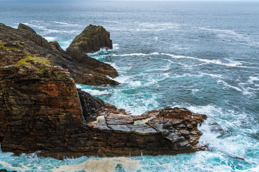
Inishowen is the biggest peninsula in Ireland and the places worth stopping at are spread right across it, which is exactly why people get it wrong. They drive to Malin Head, take the photo, and drive back, and they miss the waterfall, the castle on the rock and the pass over the Urris Hills on the way.
So here is every place on the peninsula I have written about, on one map. Click a pin to see what it is, or use the list underneath. Every one links to a full guide.
Map tiles by OpenStreetMap contributors. If the map does not load, the full list is below.
Crossing the border? Two currencies, two sets of speed limits and a hire car insurance trap that catches people out. Here is everything that actually changes when you cross between Ireland and Northern Ireland.
Coming from the north coast? The Causeway Coastal Route runs Belfast to Derry, and Inishowen starts twenty minutes past the end of it.
Every stop on the map
-
Malin Head
Ireland’s most northerly point. The signal tower at Banba’s Crown, the EIRE 80 sign and the cliff walk. -
Five Finger Strand
One of the wildest beaches in Donegal, backed by enormous dunes. Do not swim here. -
Doagh Famine Village
A famine-era settlement on the Isle of Doagh, rebuilt as an open-air museum. -
Carrickabraghy Castle
An O’Doherty ruin standing on a rock at the far end of the Isle of Doagh. -
Kinnagoe Bay
Where the Spanish Armada ship La Trinidad Valencera went down in 1588. A steep road and a hidden beach. -
Mamore Gap
The steepest road on the peninsula, over the Urris Hills, with a holy well at the top. -
Glenevin Waterfall
A flat, well-surfaced walk to a waterfall near Clonmany. The easiest great walk in Inishowen. -
Fort Dunree
A coastal fort above Lough Swilly, with gun emplacements, a museum and a very good view. -
Grianán of Aileach
A drystone ringfort on a hilltop above two loughs, twenty minutes from Derry. Free, open all year.
Flying from the US?
Most Americans pay too much to get to Ireland.
I send one email a week with the best fares from US airports into Dublin, Shannon and Belfast, plus what to actually do when you land. $14.99 for the year, refunded if it does not pay for itself.
How to use this on an actual trip
The loop road around the peninsula is signposted as the Inishowen 100, and the number is the mileage rather than anything else. You can drive it in a day. You should not.
Two days is the honest minimum if you want to get out of the car. Three is better, because the two ends of the peninsula are further apart than the map makes them look and the roads are slow in the best way.
A sensible split:
Day one, the west side. Grianán of Aileach first, because it is the closest to Derry and it orients you. Then north up the Lough Swilly side to Fort Dunree, over Mamore Gap, and into Clonmany for Glenevin Waterfall.
Day two, the north and east. The Isle of Doagh for Carrickabraghy Castle and Doagh Famine Village, across to Five Finger Strand, up to Malin Head, then down the east coast to Kinnagoe Bay.
Kinnagoe is the one people cut when they run out of day, and it is the one I would keep.
Frequently asked questions
How long is the Inishowen 100?
Roughly 100 miles. It is a signposted scenic loop that circles the whole peninsula and links nearly every stop on this map.
How many days do you need to drive the Inishowen 100?
Two days is the honest minimum if you want to get out of the car. Three is better, because the two ends of the peninsula are further apart than the map makes them look and the roads are slow in the best way.
How should you split the Inishowen 100 over two days?
Day one, the west side: Grianán of Aileach first because it is closest to Derry and it orients you, then north up the Lough Swilly side to Fort Dunree, over the Mamore Gap and into Clonmany for Glenevin Waterfall. Day two, the north and east: the Isle of Doagh for Carrickabraghy Castle and the Doagh Famine Village, across to Five Finger Strand, up to Malin Head, then down the east coast to Kinnagoe Bay.
Which stop on Inishowen do people usually skip?
Kinnagoe Bay. It is the one people cut when they run out of day, and it is the one I would keep.
Where does the Inishowen 100 start?
Derry is the gateway. It sits just south of the peninsula, and you are on Inishowen within minutes of leaving the city.
Do you need a car for the Inishowen 100?
Yes. It is a driving loop, the stops are spread right across the peninsula, and there is no public transport that joins them up.
Plan the rest of it
The full guide to things to do in Inishowen covers the towns, where to eat and where to stay. For the wider county, see things to do in Donegal.
And if you are combining Inishowen with the north, Derry is twenty minutes from Grianán and my month-by-month guides cover the other side of the border: October, November and December.
Pin this for later
Planning a trip? Save this to Pinterest so you can find it again.

Written by
Diana Greenlee
I live in County Down and write Tales of Irish Travel. After years living abroad I came home during Covid and started properly exploring the island. I write about the history and the story behind a place, not just the place. More about me.